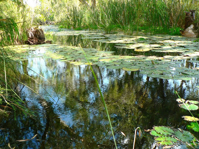
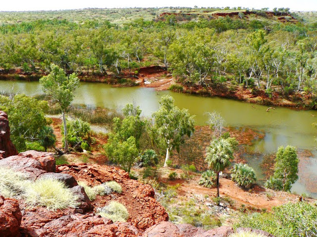
Most of it rolling hills covered in green spinifex, some escarpments & a small wetland near the homestead.
The Chichester Ranges pass through this area. The area supported sheep grazing until it became a National Pk. The large Fortescue River passes through the western side from the Hamersley Range towards the Chichester escarpment. The Chichester Range area lacks trees as apposed to lots of paperbarks & the endemic Listonia Alfredii palm around the Fortescue River & Millstream.
The Homestead was built in 1920. It is the visitor centre now housing info & relics from its working past.
The water that feeds the Millstream oasis springs from an aquifer, or the natural underground reserve contained in the porous dolomite rock. The aquifer is fed by the Fortescue River catchment.
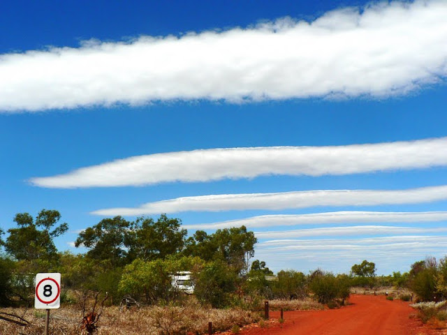
We've only had 2 cloudy days in the 4/12 of this trip. This is the 2nd & the cloud formations were quite unusual. This pic is taken at our campground. Notice the red dirt / ground. We've had this type of red soil now for over a month & our feet almost look that colour!!!
This star finch is having a drink of water from the natural spring creek. Just a chance that I should click the shutter when a bumble bee flies near the bird :)
This part of the Fortescue river is Deep Reach, not that far from where we were camped.
Driving the next part of the dirt road was mostly flat until near the northern part where the Chichester Range passes through.
Very pretty, but in stark contrast there are few trees.
Parts of the hills look like they all have been mined, but it's actually large blocks of rock minus the soil.
We also came across this around Point Samson, Roebourne, Karratha & Dampier on the coast.
Python Pool is a popular swimming place. It has a high escarpment on it's back wall, with a high water fall during the rainy season
As the dry season draws to a close the water is quite murky. That's the dry waterfall on the left.
We went for a 4.5km walk to McKenzie Springs that's supposed to be 1 hr return. More like 2 hrs return! There were little trees along the rocky hills camel trail. It used to be a camel trail.
Along the way we saw a few of these little guys. They are similar to our water dragons / frill neck lizards around Bris, but these fellas were more red ... I guess it's for camouflage against the predators such as hawks & kites.
The springs are natural flowing most of the year. It was once a watering hole for camel & bullock teams.
There were few trees, just the odd gum tree & coolibah tree. This gum looked like it was growing out of rocks.
Another sunset view from our campground.
Driving north out of the national park showed more of the same landscape - few trees, but green spinifex clumps every where. There were also some wildflowers, but not as many as seen in Karijini.
Back on the coast we stayed at a natural campground between Roebourne & Karratha. The camp spots were pic your own & a very cheap $7 / night. Only downside was it was windy. The views were pretty good once again.
When the tide goes out it reveals sea creatures such as sea slugs, some corals, & clams were spotted.
The small township of Roebourne was established around 1866. There are 8 historic buildings in town including the old goal. The goal housed some dreadful criminals. There were 5 hangings between 1893 & 1900, 3 of them on the same day for murdering the local doctor.
1 of the goal cells.
The town of Cossack was established in 1872. It was the 1st port in the North West of WA, playing host to thousands of people seeking their fortunes in gold mining. It also became home to the early pearling industry of the late 1800's until the pearls were fished out. Cossack became a ghost town once deeper waters were required for the much larger ships that came to port. Cossack municipality was dissolved in 1910. The town was abandoned by 1950. Many building were restored to their original condition & only a caretaker couple live in the town.
Most building were built around th 1880's. This is the old court house
Inside the small bakers house. Imagine baking bread here, as there were few windows for ventilation.
Dampier is a small town, growing. Most mining industry live in Karratha, but some live & work in pretty Dampier. Dampier has 4 major industries along the coast line. Salt shipping port, iron ore shipping port, Ammonia production, & Gas production from the North West Shelf 125kms away, 133mtrs deep in the Indian Ocean.
I've covered the mining industry in its own blog. The coast line is pretty like most coasts we've encountered so far. I thought I would show the area sunset pics.
Karratha is the major town servicing the area. It is 27 kms inland from the coast & is growing very fast..........
so much so that a huge estate has recently been established with the average house price being around $700,000 for a 3 bedroom 1 bathroom house to near & over $1 million for 4 bedroom & 2 bathrooms.
To rent a house of same as above examples is $1500 for the 3/1 house & $2350 for 4/2 house - that's per week folks..................................
I'm glad I don't have to live & work around this area. Even if it's a gorgeous area.
I guess you have to be part of the 4 big industries to afford to live here.


No comments:
Post a Comment