Our trip into The Flinders Ranges started from Leigh Creek, approximately 130 kms south of Marree or 574 kms north of Adelaide.
The Flinders Ranges stretches for over 430 kms from Port Pirie to Lake Calladonna, north of the Gammon Ranges, the northern most part of the Flinders Ranges.
It is early Spring, perhaps the best time to visit the Flinders Ranges to hopefully see wildflowers.
Most of the roads in the Northern Flinders Ranges are good gravel roads & accessible by 2 WD vehicles, but care should be taken for the creek crossings if it's been raining. Regardless, it's always best to check road conditions before going to these remote places. There is little phone connection in the northern section of the Flinders Ranges apart from sitting in the Information centre at Arkaroola.
Gammon Ranges NP are the northern part of the Flinders. Arkaroola Wilderness Sanctuary is a separate privately owned entity that joins the Gammon Range NP.
The drive from Leigh Creek is 100km east & then another 30 kms north to the Arkaroola Wilderness Lodge & camping area.
The Flinders Ranges region was stunning & thus I've dedicated this entire chapter to it.
The scenery as we drove closer to the NP entry is becoming quite exciting.

We stopped at Italowie Gorge for a lunch break. It has a camp ground & a walk for the enthusiastic folk.

We passed the entry to a bush camp Weetoolta & Balcanoona Gorge.

Arkaroola used to be a sheep station that has been transformed into a Wilderness Sanctuary.
Arkaroola has a an information centre, souvenir, small amount of groceries, cafe & restaurant in the 1 building.
That's the view we had from our camp spot.

Sunset over the same hills.

Walking around Arkaroola Resort there were a few artifacts. We saw this a few times in the Flinders Range. I thought it was a stone carving, but is a look alike.

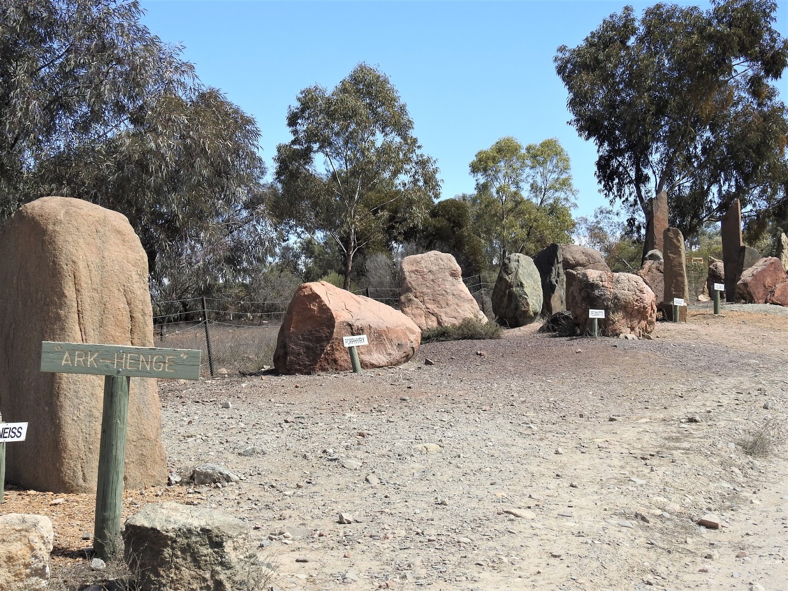
Apparently there's a few different types of rock that make up the Flinders Ranges.
Pioneers used horse drawn wagons to get supplies moved.

A horse drawn buggy.

Experimenting again with the moon & my camera.

We decided to take a walk on 1 on the trails suggested by the Arkaroola Brochure.
We were dropped off by 1 of the staff for the start of our walk & walked back to the resort approximately 4 kms.
The trail zig zagged up a hill to then follow a ridge top that gave us fantastic views.
Along the way I found that plants will grow in almost anything.


We're now at the top of the ridge line. I took loads of photos to create a panorama for 360*.
Starting south - east.


There are just so many layers of ranges behind the 1st tier of range.


That's the Arkaroola Resort down below.

Panorama now of the north - east of our lookout point.


We walked about 1/2 the gorge walk before turning around.
We were delighted to see a couple of Yellow-footed Rock-wallabies along the way.


More driving & this time to see the Ochre Wall.

We are now at the top end of the Central Flinders Ranges.
We wanted to check out Parachilna Gorge & drive a circuit route.
This is the views we had along the Blinman to Parachilna Gorge Road.


We stopped in Blinman for hubby to check the local historical hotel & I had a nice Cumquart pie & cream at the local bakery. Along the street was this unusual mining bin.

Whilst in Parachilna Gorge I walked around to find so many varieties of Mallee trees.


This was the view we had from our camp ground, looking back towards Parachilna Gorge.


A wildflower that seemed like a weed was so common.

We were back on the road again the next day. We drove a little more south to stay overnight in Brachina Gorge. Enroute we passed the "Great Wall of China". We couldn't go up much further as we were towing our caravam.

The drive into Brachina Gorge, in front of us was the Heysen Range.

We stopped at a lookout.

Driving further towards Brachina Gorge.

Parked up in the National Park camp ground at Brachina Gorge with these gorgeous views.

More stunning views were had when we took a drive to the western edge of the actual NP.
We're standing on a lookout looking back towards the NE.


Driving back through the Brachina Gorge.

We took another drive to the Aroona Ruins.

A pastoralist William Chase arrived in 1851 with 3,300 sheep. A homestead was built here at Aroona. Severe drought 1864 - 1866 cost the owner dearly & Chase eventually had to sell his sheep.
The property was abandoned.

Aroona Lookout - the Range is named after Sir Hans Heysen, 1 of the 1st Australian painters to portray the Australian Landscapes.


Heysen Range.


Looking in another direction from Heysen Range is 3 Sisters.

Aroona Hut was built in 1925 as an outstaton.


A panorama of The Heysen Range

Driving through the Brachina Gorge again.

Heysen Range from Brachina Gorge Road

More of Heysen Range from Brachina Gorge Road

Our next stop over was for me to twitch a little bird hiding in Spinifex on a hill next to this sheep station & stay.

Stokes Hill is sought after by birders looking for the Short-tailed Grasswren, found in very few places in South Australia.
There's trees in the distance to the right of this photo.....that's where I had to walk to locate my target bird. I found the bird on my 2nd visit the next morning.

Along the way was this Euro kangaroo.


Interpretive signs tells us how the Flinders Ranges formed.


More stunning scenery as we head south towards Wilpena Pound.


We checked in to Rawnsley Tourist Park & asked about flights over "The Pound". We booked a scenic flight for 2 hrs time, so our sightseeing for the afternoon was sealed.
The 30 minute flight was wow, wow, wow.
Wilpena Pound is a natural amphitheatre. Contrary to earlier reports, Wilpena Pound is not the result of an ancient volcano but is sedimentary rock in the form of a large syncline.
See photo a little further back to understand some of it's formation.


That's ABC Range

Elder Range

Eastern side of Wilpena Pound.


Southern side of Wilpena Pound

Western side of Wilpena Pound

Heysen Range further north of Wilpena Pound

Bunyeroo Gorge in Heysen Range - not part of Wilpena Pound

Brachina Gorge in the Heysen Range.

Brachina Gorge again

More of Brachina Gorge

The road through to Brachina Gorge

northern side of Wilpena Pound

St Mary's Peak is the highest point of Wilpena Pound at 1,171m high (front right range)

Rawnsley Bluff stands at 950 m tall.

Coming back to ground level.

For the rest of the afternoon we decided to take a drive back past Rawnsley Bluff. It is so spectacular & scenic.

The next day we decided we would like to see inside Wilpena Pound. We stopped at a couple of places before the Information centre to take advantage of the light on the eastern side of Wilpena Pound.


I see a dragon there on that mountain of Wilpena Pound.

On the walk into The Pound we saw this nesting box that was intended for birds or Sugar Gliders, but has been fully occupied by honey bees.

In the late 1800's Wilpena Pound was used for sheep grazing.

A pug & pine shepherds hut was built in 1888 by the Hills family & used whilst they cleared timber within the pound. In the 1900's the hut was replaced by this stone house.

Some of the original ploughs & boiler. Unfortunately sheep farming came to an abrupt halt as a result of severe drought & it was abandoned.

I was rather surprised to see so many dead trees within the pound & on the walk to / from the pound to the Information centre. The dead trees are a result of the coldest winter in several decades.....more than 14 nights of sub zero temps.

The walk up to the lookout giving great views of part of the 82 square km expansive area within Wilpena Pound.

A panorama within Wilpena Pound.


I was rather interested in the seeds on this Casuarina tree.


Still up on the lookout trail. Trail walkers love adding more stones to this cairn.

Unknown flowering bush.

Fern growing in a shady spot on the lookout walk.

This ended our wonderful experience in the very beautiful & scenic Flinders Ranges. We had spent a wonderful 10 days in the Flinders Ranges.
We drove further south to Port Augusta the next day.
No comments:
Post a Comment