I've placed this map here at the beginning to give you an idea of our route. The distance east to west is approximately 190 kms & north to south is 78 kms.
Our route was anti-clockwise from Penneshaw in the east.


The workers loading vehicles onto the ferry are experts & everything is reversed on. There is barely 1.5 metres between vehicles.

Everything required on the Island is taken over on trucks via the ferry. This tanker is full of fuel & as the ferry rocked for the 50 minutes trip, I could see the tanker of fuel rocking a little sideways.
I'd not be happy if the seas were any rougher.

Arriving at the ferry terminal at Penneshaw on Kangaroo Island.

We unhitched at the local caravan park & started our local site seeing. 1 of the bays at Penneshaw.

The next day, hubby had a game of golf at the local club & I of course went birding.
This kangaroo is a Tammar Wallaby - endemic to South & Western Australia, plus the islands including KI.
Apparently they have the ability to drink seawater. This 1 is a female with a joey in her pouch.


Another bay near the township is quite rugged - strands of upright rocks.

Armed with our trusty map of KI, we started to explore the Island ....pun intended - we headed in an anti clockwise direction & drove to our next camp spot at American River.
We passed through Baudin Beach. The town was named after the French explorer who anchored in the bay there for several weeks in 1803.


Sites at Baudin Beach.

American River was 1st visited by Europeans in 1802 when Matthew Flinders landed to survey KI.
A group of American sealers camped there in 1803. The town isn't on a river, but the name stayed from those days. A fish cannery existed for a few years in the late 1890's. Gypsum as mined nearby 1956 - 1986.
Do you like their "marooned ship"?
I do like the use of planks to create the ship.


Inside the local cafe in American River with friendly folk behind the counter. But I'd love to always eat desert first when eating a meal.

Exploring around American River we found many old farming machinery like these.


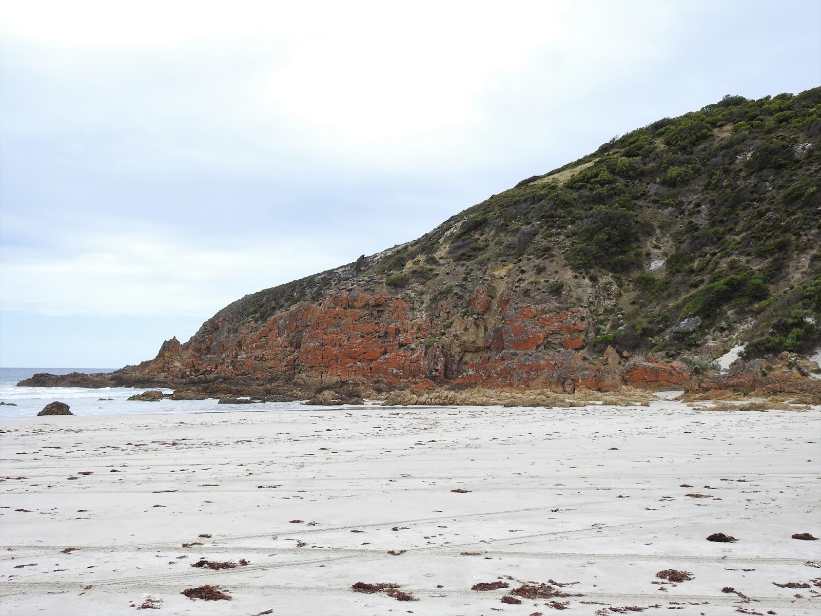
We visited the very picturesque Red Cliffs on another bay near American River.

Driving further with another bay called Emu Bay.


Kingscote is the biggest town of Ki with more services.

I'm guessing that this mulberry tree is perhaps up to 200 yrs old. Alas some of it is propped up with a pole to save the poor old thing.

Also near Kingscote is Bay of Shoals area There is also a winery of the same name where hubby had a tasting.

Another Tamar Wallaby

We explored a wetland along a river at Duck Lagoon. It has a free camp spot there as well as some great birding. The reserve used to be a sheep station & several pieces of old cars have been left behind.


The farming area had several industries - sheep & wool, dairy cattle, creamery, fruit orchard & crops.
There is also evidence of timber milling & an eucalyptus still in the early 1900's.


We visited a Sheep Cheese making factory. I'm a former sheep farmers daughter & I've not ever tasted sheeps milk, let alone see them being milked. Wow, it's the same concept as milking a cow, but just milking a different animal. I didn't like the cheese, but the yoghurt was Ok.
Hubby bought some cheese to take back to the caravan.

A distillery wasn't that far away, so of coure we checked them out too for a tasting.
kis - Kangaroo Island Spirits is the brand name of the distillery.

We had a tasting of a couple of their products & drove away with a bottle of Honey & Walnut liqueur.

Wisanger Lakes along Emu Bay Road. There are at least 2 salt lakes that were great habitats for birds.


We stayed at a private property camping ground called Discovery Lagoon. It had all the amenities apart from 240v power. Usually the lagoon fills during their wet season, & un fortunately there wasn't much water left. There is shallow water about 200m away with plenty of wildlife on it.

Not far from our camp ground there was a private home castle called George's Castle. It was closed when we went past.

There are 52,000 lights usually shining most nights.

After fulling visiting Emu Bay area we moved to the northern side of KI to stop for the night at Stokes Bay. There's little there apart from a camp ground with no 240v power, but there is a cafe that had delicious fish & chips. The murals here were painted on the amenities block walls - ladies side.


Stokes Bay views.


There's a walkway through these boulders to get to the Rock Pool.

Finally the real beach at Stokes Bay. It's quite shallow, & very popular in the summer months.

We took a drive eastwards along the coast & found a few more bays - King George Beach.


Snelling Beach & the beach holiday house couldn't be any closer.

Views down to Snelling Beach. Misty rain was coming in, so we retreated back to our caravan & an early dinner at the cafe at Stokes Bay.

We moved camp again & drove through the country side to Western KI Caravan Park & booked in for 4 nights. The caravan park was our base for & easy access to the Flinders Chase Conservation Park, National Park & several other attractions on KI's western shores.
Cape Borda is on the North-west tip of KI. The lighthouse is the only square lighthouse built in South Australia, is just 10 m high & was 1st lit on 1858. I was built to guide ships travelling along the Roaring Forties trade route into Investigator Strait towards Port Adelaide. Before roads linked Cape Borda to the rest of KI, supplies had to be hauled up from ships via a steep steel railway at a nearby cove.

The workers cottages are now accommodation houses.

We were in time to take a tour through the lighthouse. These are some of the old equipment used to run the lighthouse.

The beaming light to alert ships of the rocky coastline.

Scott's Cove was near Cape Borda. The boat down there was actually a large vessel, but dwarfed by the expanse of the bays size.

Ravine des Casoars is a Wilderness Protected area on the western end of KI. Proclaimed in 1993, the 41,800 hectare area borders Flinders Chase NP, & therefore forming 1/3 of KI under NP or Wilderness Protection against farming etc.
We came across this Goanna when walking the track to the beach.


We also came across giant ants.....they were at least 2 cms long. I'll bet they're bite packs a punch too.

Towards the end of the walk we came to limestone cliffs with caves.


An Echidna.

We didn't realise when we parked our caravan earlier that we were nearly right under a Koala. Wandering around the grounds, I found several more Koala's.

The next day we headed for the most popular tourist attractions of KI.
Remarkable Rocks is within the 326 square km Flinders Chase National Park.
The granite rocks of Remarkable Rocks have been carved away by the weather & pounding waves from the Southern Ocean for 500 million years.


Just a few kms down the road is the Cape du Couedic section of Flinders Chase NP with a Lighthouse, Admirals Arch & a colony of NZ Fur Seals.


Admirals Arch has been created with wind, rain & waves from the Southern Ocean.


More of those NZ Fur Seals.


The lookout boardwalk near Admirals Arch.

Cape du Coeudic Lighthouse was built between 1906 & 1909 using 2,000 pieces of local stone. There are 3 cottages that housed the head keeper & 2 assistants & their families. Supplies were hauled up to the lighthouse by flying fox winching powered by 2 horses. The cottages are now used as accommodation houses.


The flying fox winching area where supplies were hauled up with the help of 2 horses.
A really an amazing innovation by our pioneers.


I did some more wandering around the caravan park later in the day looking for more birdlife.
Banksia are 1 of my favourite Australian native trees.

I think this kangaroo is actually a Wallaroo or Euro....with a joey in her pouch.

The next day we explored more of the area with a visit to Kelly Hills Conservation Park.


Kelly Hills was once a sheep property. I think the story goes that a horse fell down a cave hole & soon after this wondrous network of caves wasdiscovered. Entry is by a pre paid guided tour. The tour takes about 1 hr.


Further along the coast was Hanson Bay with a creek inlet.


Wildflower seen whilst walking the trail.

The next day we moved camp to Vivonne Bay free camp spot for exploring that area.
This is Vivonne Bay.

The jetty at another section of Vivonne Bay.

Seal Bay Conservation Park wasn't far from Vivonne Bay.
We had a ticket to go on a guided walk to see the Australian Sea Lions. The group of 15 people had to stay close to each other for safety reasons as some of the sea lions can be unpredictable to attack single people.
We were on the beach with dozens of the animals that had variable range of age with the bulls weighing up to 350 kg.
These are 1 of the rarest species in the world with 85% of their entire population of less than 12,000 living in South Australia. The other 15% live in Western Australia.
Seal Bay is the 3rd largest colony of the Aust Sea Lions, with an estimated population of 800.


In winter, the sea lions tend to move back onto the sand dune for warmth. We found several amongst these trails & under the boardwalk from the information centre down to the beach


We were told this is a Humpback Whale skeleton.


Murray Lagoon is on the northern edge of Cape Gantheaume CP. The free camp spot also had flushing toilets near the rangers house.
We then were able to explore Cape Gantheaume CP & Wilderness Protection Area & d'Estrees Bay.
I saw another goanna sunning itself.

The drive along d'Estrees Bay had many camp spots & stopping areas to explore.
The bay extends from Point Tinline to Point Reynolds. The bay dates back to the early whaling industry, shipwrecks, farming, conservation & is popular as a fishing spot & sandy beaches.
Farming commenced in the area around 1876 when the Wright family lived in a tiny house in the bay.

John & Emma Wright & their 5 children lived in this tiny dwelling.

1 of the pretty sandy beaches at d'Estrees Bay.

Further down towards the end of the road & we found this impressive bay that is far from being sandy.


We had finished exploring most of KI & were back at the beginning at Penneshaw in wait for our return to the mainland the next morning.
There was still 1 more section of KI yet to explore. It was Cape Willoughby & Lighthouse, further along the coast SE of Penneshaw.


We visited this winery for a farewell Kangaroo Island lunch celebration. Dudley Wines & Cellar Door have a splendid building built onto the side of a hill over looking an even more gorgeous bay.


Hubby & I shared this magnificent Gourmet Pizza. From memory it was slow roasted Moroccan Lamb, slivered almonds, cranberries, capsicum, & other little vegies, plus a drizzle of yoghurt on top. Yum & even better with a glass of their locally produced wines.

We had an early rise for our KI departure. This view is just wow.

I mentioned at the beginning of this chapter that everything has to be shipped over to Kangaroo Island via the ferry. Kangaroo Island is a major sheep grazing place. There are no abattoirs on KI & so the sheep are taken by truck back to the main land. There were 5 trucks reversed onto this mornings ferry. 3 decks per truck, 28 sheep per little pen = about 2,000 lambs in this shipment.
This is an almost daily event during spring.

Farewell Kangaroo Island. We spent 10 days exploring this little Island.
No comments:
Post a Comment